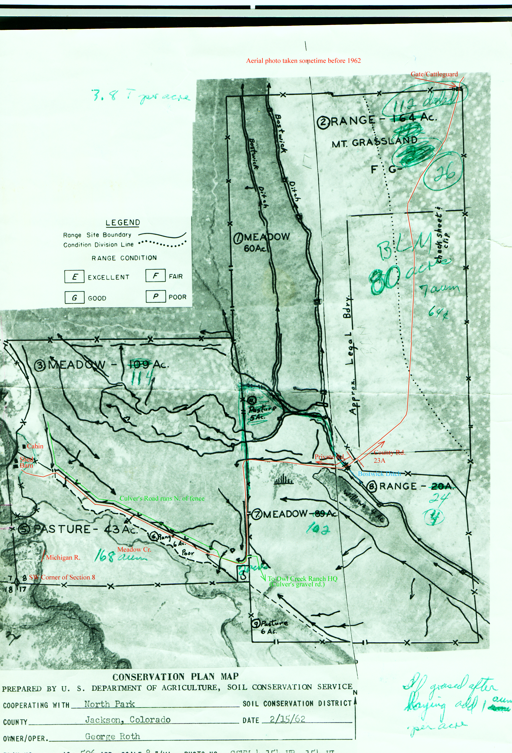
Here are pictures to help you visualize the lay of the land and where the roads go. These are big images, but that's the only way to show the detail.
This aerial photo is oriented like a regular map (North up, East
right). It shows the ranch area in the lower left. I put the red and
green notes on. The green scribbled notes were on there (Roth?)
already. I had thought that, just north of the bridge across Bostwick
ditch, the road became Jackson County road 23A. Certainly somebody
comes with a large grader and grades it from time to time.
Aerial Photo 1962
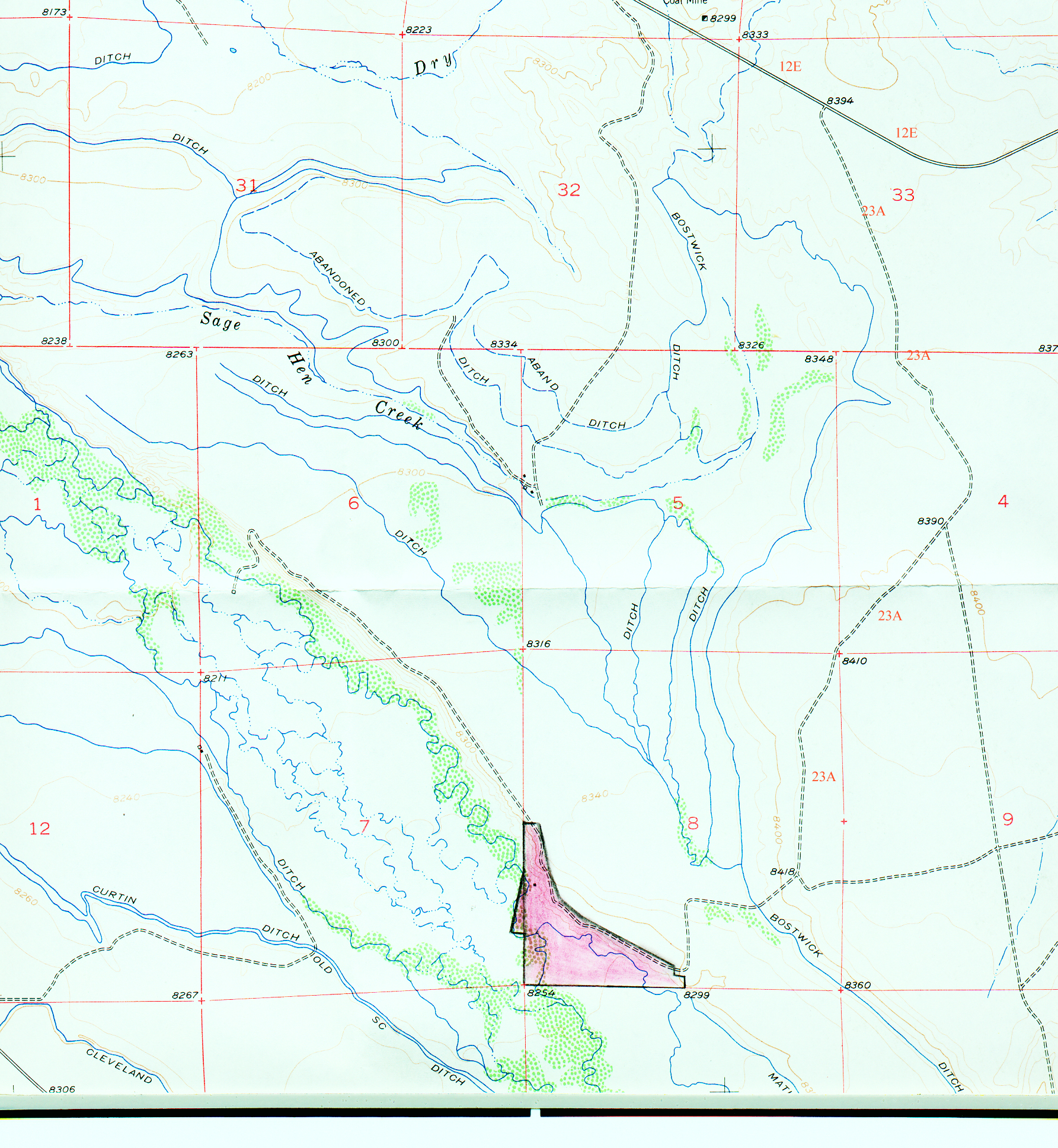
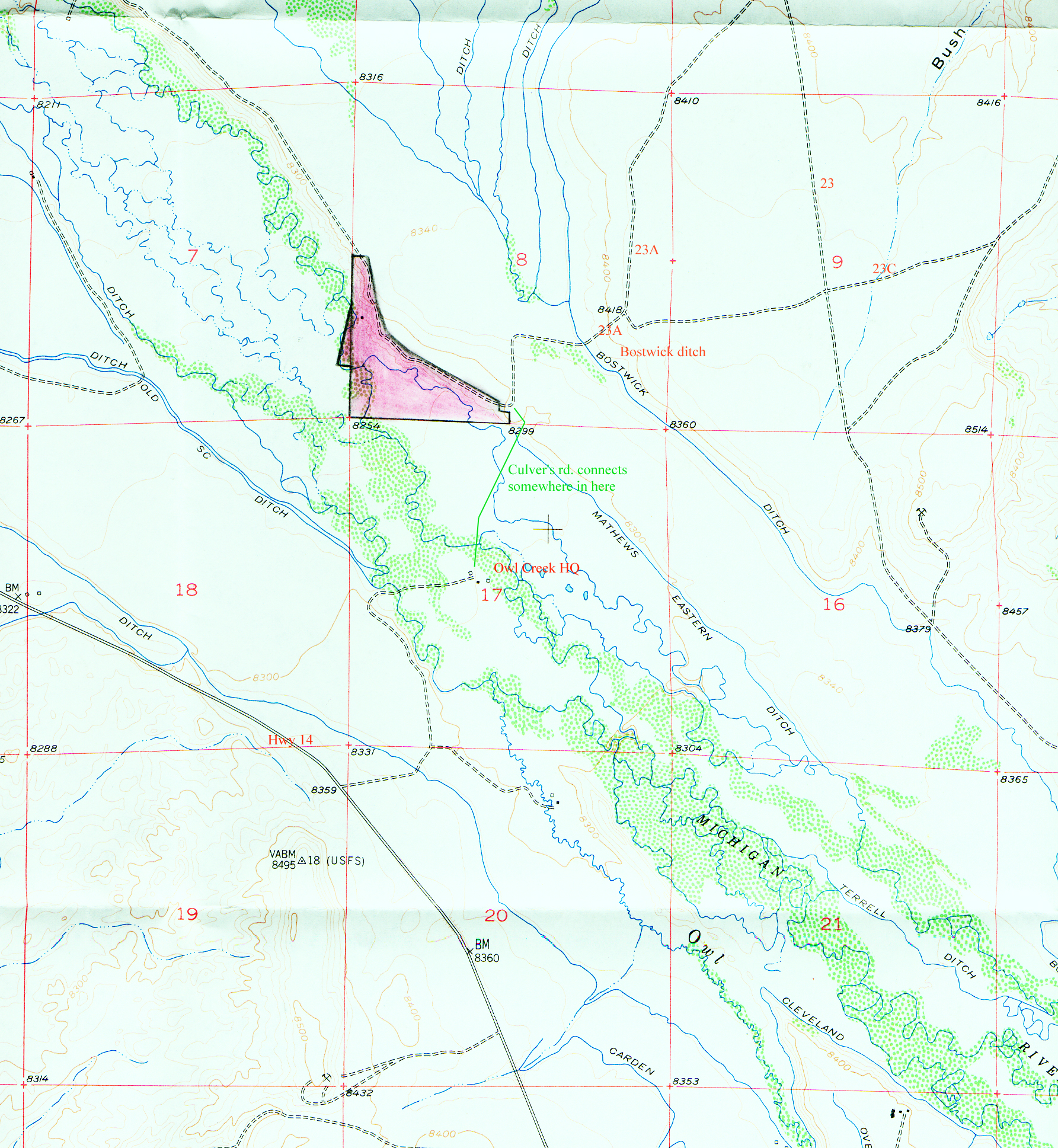
These three are scanned from a quadrangle map. Someone (my dad?)
sketched in the location of the 60 acres. I've added some labels for
roads and other notes.
Zoom in near Ranch
North of Ranch to County Rd. 12E
South of Ranch (Hwy 14, Owl Creek)